About HIS AI Agency

Engineering intelligence for real-world decisions.

HIS AI Agency is an engineering-led AI, GeoAI, data and spatial intelligence practice. Its strength comes from deep geospatial and engineering experience combined with modern AI engineering.

Conceptual visualization only

The engineer behind HIS

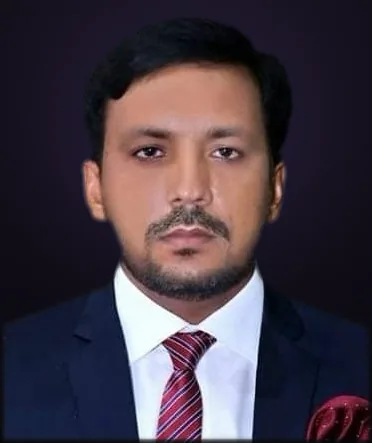
Meet the engineer behind HIS

Muhammad Safdar

Data Scientist · AI/ML Engineer · GeoAI Specialist

From spatial data and infrastructure systems to AI-powered decision intelligence.

Muhammad Safdar is a Data Scientist, AI/ML Engineer and GeoAI specialist with 10+ years of professional experience across GIS, remote sensing, spatial databases, infrastructure, utilities, agriculture, disaster intelligence and data-driven decision support.

His work extends established geospatial engineering into Python, data science, machine learning, deep learning, RAG/LLM applications, APIs, GeoAI, remote-sensing automation, BIM–GIS integration and digital intelligence.

  • 10+ years professional delivery
  • MSc GIS, University of the Punjab
  • GIS + GeoAI + AI/ML
  • Pakistan + GCC experience
  • 20+ professionals trained in GIS workflows
  • 8 industry domains

Career experience, not HIS client delivery. Full disclosures

Muhammad Safdar, founder of HIS AI Solutions

Have a complex data, AI or spatial problem?

Bring us a workflow, data problem or spatial challenge. We will help identify where AI and automation can create a practical starting point.

Professional philosophy

Why HIS approaches AI differently from a generic AI agency.

AI built on domain understanding

Strong AI systems start with understanding the data, workflow and environment they operate in, not with choosing a model.

Evidence over claims

Professional delivery, public demonstrations, prototypes and active development are labelled separately. Unmeasured results are not invented.

Engineering, not decoration

We engineer AI systems around real workflows, data and operational constraints, with validation and human review built in.

Career timeline

A concise progression from field GIS to AI-driven decision intelligence. Client-sensitive work is summarized.

  1. 2012–2015

    GIS Assistant / GIS Associate

    The Urban Unit & Loyal Consultants

    Mapping, digitization, field-survey integration, spatial analysis and cartography.

    GIS foundations

  2. 2015–2017

    Junior GIS Professional

    The Urban Unit

    Urban, land, infrastructure and survey-focused GIS delivery for public-sector planning.

    Enterprise spatial systems

  3. 2017–2019

    GIS Manager

    PDMA Punjab, PIU Multan

    Flood intelligence for Chenab and Sutlej influence areas, exposure analysis and emergency mapping.

    Disaster intelligence

  4. 2019–2021

    GIS Manager

    Kernel Seeds Corporation

    Geodatabase management, georeferencing, crop analysis and precision-agriculture information.

    Agriculture & remote sensing

  5. 2021–2023

    GIS Specialist

    FGEHA, Islamabad

    CAD-to-GIS transformation, topology, cadastral and infrastructure geodatabases; 20+ staff trained.

    Infrastructure data

  6. 2023–2025

    GIS Expert

    TerraSense Consulting

    GeoAI land-cover analysis, satellite crop intelligence, wheat estimation and predictive workflows.

    Data science & GeoAI

  7. 2025–Present

    GIS Specialist, GeoAI-focused delivery

    Professional Geo Tech Services FZC LLC

    Utilities, infrastructure, GNSS and environmental spatial delivery across KSA/UAE assignments.

    Intelligent systems

Technical evolution

  1. 01Maps
  2. 02Spatial databases
  3. 03Remote sensing
  4. 04Analytics
  5. 05Machine learning
  6. 06GeoAI
  7. 07Decision intelligence

This progression, spatial engineering first and AI second, is the core differentiator behind HIS.

Experience that informs the engineering

How a decade of spatial and data delivery translates into what HIS can build.

Geospatial systems

  • Enterprise GIS
  • Spatial databases
  • Remote sensing
  • Field / GNSS workflows
  • Web GIS
  • Spatial QA

AI & data

  • Python
  • Data science
  • Machine learning
  • Deep learning
  • RAG / LLM applications
  • Forecasting
  • Computer vision

Engineering intelligence

  • CAD-to-GIS
  • BIM–GIS
  • MEP document intelligence
  • Infrastructure data
  • UAV / photogrammetry
  • Digital workflows

Decision intelligence

  • Disaster risk
  • Utilities
  • Agriculture
  • Infrastructure
  • Environmental intelligence
  • Operational dashboards

Engineering DNA

We understand the full path from raw data to usable intelligence.

  1. Data
  2. Processing
  3. Modeling
  4. Validation
  5. Application
  6. Decision
  7. Monitoring

Credentials

MSc GIS

University of the Punjab

Remote Pilot Certificate

GACA, Saudi Arabia

Spatial Data Science

Esri

Imagery in Action

Esri

Python with Full Stack AI

NexSkills · 2026

Artificial Intelligence Using Python

DigiSkills · 2026

Data Analytics & Business Intelligence

DigiSkills · 2026

Python Essentials 1

Cisco

Public engineering work

Independent technical projects and demonstrations, each labelled with its actual status.

Public demonstration

GeoAI · Disaster Intelligence

Pakistan National Flood Intelligence

District-level flood decision support combining weather outlooks, flood impacts, river observations, reservoir storage, rainfall analytics and GeoAI scenario planning across 35 districts.

  • TypeScript
  • GeoAI
  • Spatial analytics
  • Decision support
Live demonstration

GIS · Spatial Decision Support

Pakistan Infrastructure GIS Command Centre

GIS dashboard for infrastructure and transportation planning, project monitoring and spatial decision support across public-development workflows.

  • GIS
  • Infrastructure
  • Transportation
  • Dashboards
Live demonstration

GeoAI · Spatial Resilience

GeoAI Resilience Intelligence Suite

Five unified spatial workflows for urban suitability, flood response, utility risk, drainage capacity and Earth-observation change detection.

  • GeoAI
  • GIS
  • Hydrology
  • Remote sensing

Contact

Bring us a workflow, data problem or spatial challenge.

Team size and commercial details are not publicly disclosed. Where client details are confidential, we say so rather than publishing an estimate.

Ready to scope your AI initiative?

Share your objective and constraints. A specialist reviews every request before any recommendation is issued.